may 24, 2016 - dodge city, kansas tornado outbreak
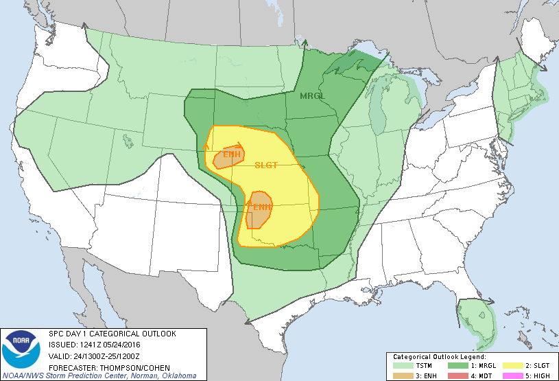
Topping off a very active week of severe weather in the Great Plains, nature had one last surprise for us. We targeted the town of Minneola, Kansas after some debate. We got to town as the cumulus field was developing. We watched cannonball cumulus, a sign of a extreme instability.
A storm quickly broke the cap and began moving Northeast. We watched it form a wall cloud and quickly show the telltale signs of tornadogenesis. There were two distinct areas of rotation and the southern one produced the first tornado. The two areas merged together and briefly disrupted the process as a stout funnel hovered above farmland south of Dodge City. The storm finally got things straightened out, planting a photogenic stovepipe tornado that remained on the ground for 20 minutes. The supercell then cycled and produced its second tornado. Another EF3 stovepipe. The storm kept producing tornadoes for the better part of two hours. At one point, three tornadoes were simultaneously occurring. On two occasions there were twins on the ground. By the time it was all said and done, chasers lined all sides of the roads and the storm had produced upwards of a dozen tornadoes!
We finally took our escape route to the east before dropping south to safety as storms clustered over the area.


May 23, 2016 - Tornado Warning Follett, Texas
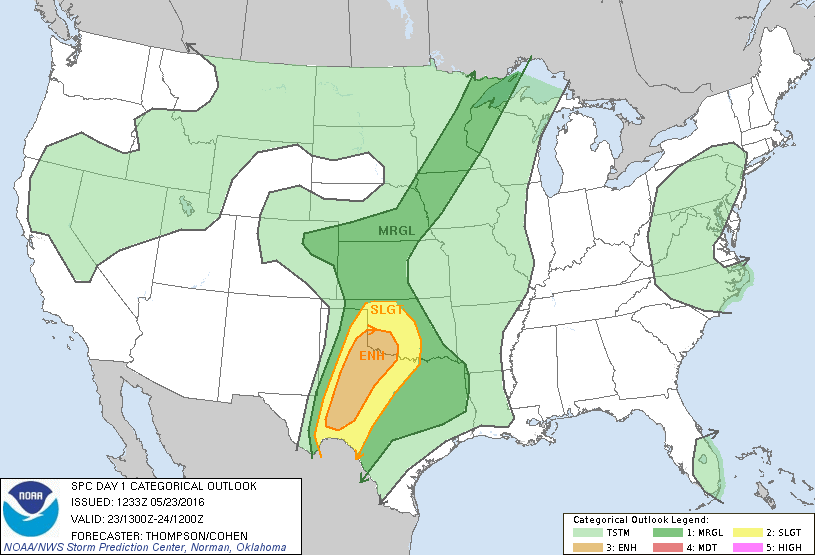
I really wasn’t thrilled with the way the week had gone. We had been on storms and seen a tornado, but we should have seen more. I’d never dealt with a group this size and several of them knew about weather, so I took a lot of opinions into consideration.
It really bit us in the behind on this day. We targeted Shamrock and we watched a storm south of there struggle for a bit. Everyone was impatient and wanted to head towards Canadian and developing storms there, so we did. The storms we went to managed to acquire enough rotation to be tornado warned, but lost to the cap. The one we left went on to produce a large wedge tornado at dark. Good lesson learned this day that paid off big time the following day.


may 22, 2016 - groom, texas
rope tornado
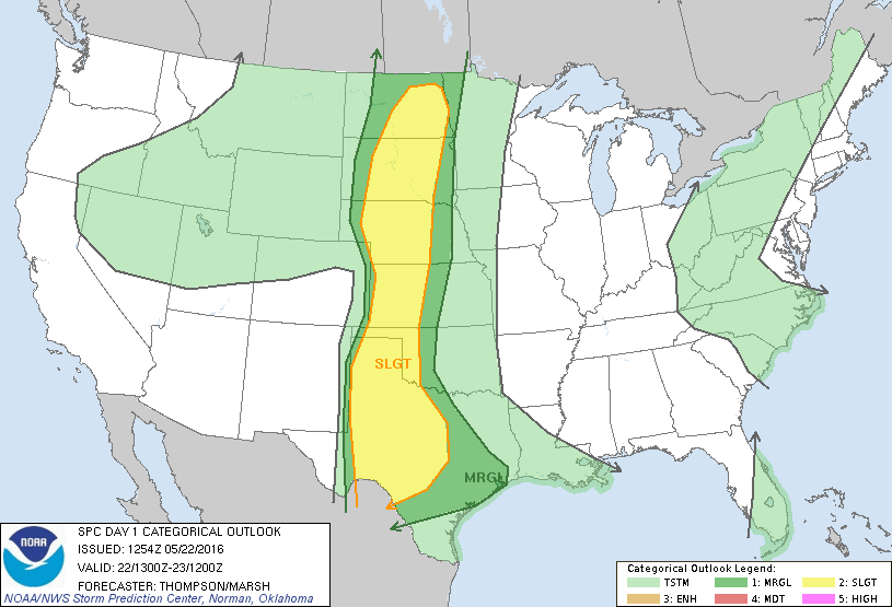
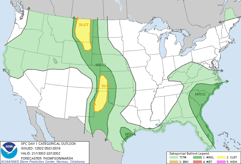
The day was a Slight Risk up and down the dryline with a 5% tornado probability in the Texas Panhandle.
While repositioning, the storm produced a fairly photogenic, white tornado on the backside of the mesocyclone. Our day ended quickly after this tornado due to messy storm mode and flooding from torrential rainfall.


May 21, 2016 - Leoti, Kansas Supercell
This was the first day of running a big group storm chasing tour. Predictably, it couldn’t have gone much worse. We targeted well but were on the north side of the storm when it went up late in the afternoon. The light was incredible, so we shot a rainbow for several minutes and managed to get cut off by hail on our way back around the storm. Mistake one.
We waited the hail out and decided to make up time by taking a shortcut. Mistake two. The shortcut actually ended up going through an open field complete with livestock.
Finally got out of the fields and caught back up to the storm on a dirt road. Mistake three. The dirt was actually mud, which I can only describe as driving on slimy ice. We got stuck temporarily but were able to push it out. We finally setup on a hill and shot the mesocyclone and mammatus clouds.


may 16, 2016 - three tornadoes in Oklahoma, texas, and new mexico
We targeted the triple point in Southeastern Colorado and the storm initiated in Kim, Colorado. It was initially elevated, but had very large mammatus clouds aloft.
We chased the storm into the Oklahoma Panhandle. Where it became tornado warned. It produced an elephant trunk tornado south of Boise City before producing a rainwrapped cone tornado north of Stratford, Texas.
We ended the day watching a tornado east of Clayton, New Mexico.


April 26, 2016 - Tornado Warning in Oklahoma, Upward Lightning in Texas
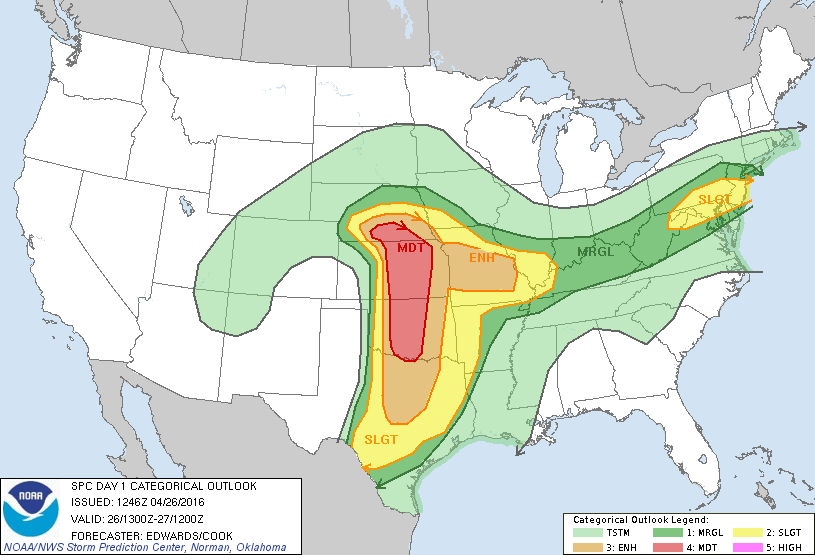
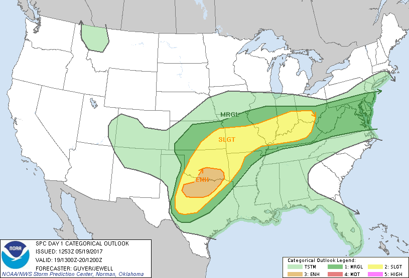
What looked like a big day with a Moderate Risk and 10% hatch for significant tornadoes (which was upgraded later to 15%), severely underperformed with storms going up very early and never able to organize much.
We chased a tornado warned supercell near Altus, Oklahoma with some marginal storm structure. When it became apparent the day was going to be a bust, we started back towards Austin. We caught up to the line of storms near Waco and stopped to shoot some anvil crawlers on the backside of the storm. Then the magic happened. Upward triggered lightning started firing off communications towers south of town. I had seen it in the distance, but never so close. Really cool experience, that to me was just as good as seeing a tornado.


